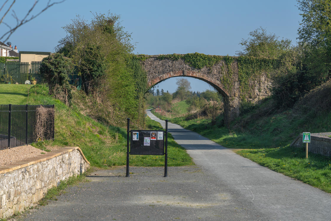

The Boyne Valley is a destination steeped in history, but it is also a wonderful place to get outdoors and explore the landscape at a slower pace. From riverside paths and historic canals to peaceful countryside and important heritage sites, the region's greenways offer a different way to experience the Boyne Valley.
Whether you are looking for a gentle walk, a family cycle or a longer day exploring the countryside, there are greenway routes to suit a range of abilities. Along the way, you can discover historic towns, waterways, wildlife and some of the landscapes that have shaped the story of the region.
Here is our guide to some of the greenways to explore in and around the Boyne Valley.
1. Boyne Greenway
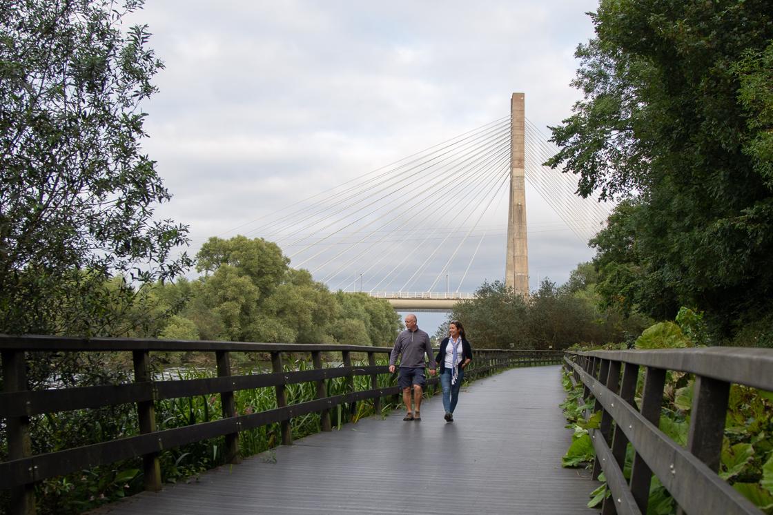
The Boyne Greenway offers a scenic riverside route connecting Drogheda with the historic landscape around Oldbridge.
Starting at Dominic's Park on the south bank of the River Boyne, close to the Bridge of Peace in Drogheda, the route follows the river towards the Mary McAleese Cable Bridge before continuing alongside the Boyne Canal to the Battle of the Boyne Visitor Centre at Oldbridge.
The current route is approximately 4.5km long and provides lovely views of the River Boyne and its surrounding landscape. The walking and cycling facility includes sections of boardwalk, creating a pleasant waterside connection between Drogheda's town centre and the Oldbridge Estate via the existing ramparts.
There is more to discover than scenery along the way, too. Heritage signs positioned along the boardwalk provide information about Irish mythology and the stories associated with the Boyne Valley, adding an extra layer of history to your journey.
Once you reach the Oldbridge Estate, there are also a number of self-guided walks through the parkland around the Battle of the Boyne site. It is well worth allowing extra time to explore the estate rather than simply turning around at the end of the greenway.
Find out more HERE!
2. Boyne Valley to Lakelands Greenway
Stretching for approximately 30km from Navan in County Meath to Kingscourt in County Cavan, the Boyne Valley to Lakelands Greenway is a wonderful way to explore the countryside, villages and heritage of the northern Boyne Valley.
Following the route of the former railway line, the greenway passes through or close to Kilberry, Wilkinstown, Castletown Kilpatrick, Nobber and Kilmainhamwood before reaching Kingscourt. With a largely traffic-free route and plenty to discover along the way, it is ideal for walkers and cyclists looking to explore the area at their own pace.
The greenway is divided into six sections:
- Blackwater Park, Navan to Gibbstown Station: 3.7km
- Gibbstown Station to Wilkinstown: 4km
- Wilkinstown to Castletown South Entrance: 4.5km
- Castletown North Entrance to Nobber Station: 4.3km
- Nobber Station to Kilmainhamwood Station: 4.4km
- Kilmainhamwood Station to Kingscourt: 7.1km
There are also shorter trails to enjoy, including the Castletown Trail, at 3.5km, and the Nobber Trail, also 3.5km.
Navan
The journey begins in Navan, the largest town in County Meath, located where the River Boyne and River Blackwater meet.
Navan has a history stretching back centuries. The town developed as an Anglo-Norman market town in the late 12th century, while the surrounding area is home to important archaeological and historic sites including the Hill of Tara and Athlumney Castle.
Today, Navan is a lively town with plenty of shops, cafés and restaurants, making it a useful base before or after your greenway adventure. For arts and culture, the Solstice Arts Centre is also worth a visit.
Kilberry
A short distance from Navan, Kilberry offers a glimpse into the area's medieval past.
The village is home to the ruins of a medieval church and graveyard containing a chest tomb, ornate grave slab and medieval font. A large ringfort at Rathcoon, just east of the village, can also be seen from the graveyard.
The surrounding area has its own fascinating agricultural history, including connections with the Everards of Randalstown House, who were known for their local tobacco plantations.
If you're looking for somewhere to stop for food, The Kilberry Restaurant is close to the greenway and serves breakfast, lunch and dinner seven days a week.
Wilkinstown
The greenway continues towards Wilkinstown, situated where the main Navan to Kingscourt road meets the old railway line.
Wilkinstown has connections with the events of 1798. Following their defeat, United Irishmen from Wexford and Wicklow travelled north through Leinster before being caught and scattered by Crown forces at Knightstown Bog, just north of the village.
Local folklore tells how people in the area helped shelter those who were fleeing.
For families, the playground at Wilkinstown Community Centre is located just off the greenway, while the village's monthly market takes place on the first Saturday of each month.
Wilkinstown is also home to facilities that make it a particularly useful starting point for a greenway adventure. Park Beo offers outdoor space, safe off-road parking, accessible toilets, baby changing facilities, picnic areas, bike parking, a coffee trailer and direct access to the greenway.
Need a bike? Feel Good Bikes provides bike hire, including regular and e-bikes, as well as a bike service area, making Wilkinstown an excellent base for exploring the route.
Castletown Kilpatrick
Further along the greenway is Castletown Kilpatrick, a small village with medieval origins.
The remains of the original medieval parish church of St Patrick can be found north of the village, alongside a graveyard containing a medieval cross-slab and other architectural fragments. The village also has a Catholic church dating from the 19th century.
For those who want to stretch their legs a little further, the Castletown Walking Trail connects with the greenway and offers a short looped walk. There is also a pitch and putt course beside the school, providing another option for visitors taking a break from the greenway.
Nobber
One of the highlights along the route is Nobber, an ancient settlement with roots stretching back to Mesolithic Ireland, around 6,000 BCE.
The town's name comes from the Irish an Obair, meaning "the work", referring to the Norman motte at the northern end of the village. The remains of the motte can still be seen today.
Nobber has a remarkable history. Nearby Moynagh Lough contains the remains of an important prehistoric settlement built on artificial islands known as crannógs. During the early Christian period, Nobber became an important monastic settlement, with nine High and Latin crosses from the site still visible in St John's Cemetery.
The town also has strong Anglo-Norman connections. Gilbert de Nangle established a motte and bailey fort here following the Anglo-Norman invasion, while the cemetery contains the tombs and memorials of prominent local Norman families.
Nobber was also home to the famous blind harpist, composer and Gaelic singer Turlough O'Carolan, who lived from 1670 to 1738. More recently, renowned archaeologist George Eogan was born in the area.
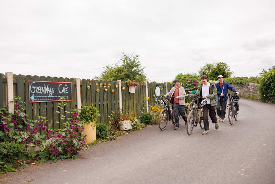
For visitors following the greenway, Nobber is a natural place to stop. There are cafés, shops and bars in the village, including the Greenways Café, which serves breakfast, lunch, speciality coffee, artisan local produce and plenty of treats.
You can also take the 1.5km Slí na hOibre looped walking trail, with access points on either side of the village.
Kilmainhamwood
The greenway then continues through the picturesque village of Kilmainhamwood in north Meath.
The village takes its name from Kilmainham Priory in Dublin, as the Knights Hospitaller, who were based there, also owned land in this area.
The site of the original medieval church remains as a graveyard to the north-west of the village, where visitors can see a medieval font and cross-slabs. A bullaun stone, an early Christian man-made hollow in stone, can also be seen in the wall of the modern Catholic church.
Nearby Whitewood Lake provides another opportunity to enjoy the surrounding countryside.
For refreshments, G'N'R Cafe, located beside the former Kilmainhamwood railway station on the greenway, offers walkers, cyclists and families a welcoming place to stop for homemade cakes and refreshments.
Kingscourt
The final stop on the Boyne Valley to Lakelands Greenway is Kingscourt, a busy market town in County Cavan close to the Meath border.
Its Irish name, Dún an Rí, translates as "fort of the king". Kingscourt was also the terminus of the railway branch line followed by today's greenway. Passenger services ended in 1947, but the railway continued to have an important commercial role, with trains carrying gypsum ore from Kingscourt until 2001.
Today, the old railway route has taken on a new life as a greenway, allowing walkers and cyclists to experience the landscape from a very different perspective.
With historic villages, medieval sites, cafés, family-friendly facilities and plenty of countryside along the way, the Boyne Valley to Lakelands Greenway is much more than a route from A to B. Whether you're planning your own walk or cycle at another time of year, the Boyne Valley to Lakelands Greenway is one of the best ways to explore the northern part of the region.
3. Royal Canal Greenway
The Royal Canal Greenway is a 130km level towpath that offers an excellent option for walkers, runners and cyclists of all ages and abilities.
The full route begins in Maynooth and follows the 200-year-old Royal Canal through Enfield and Mullingar before reaching Cloondara in County Longford. Along the way, the landscape changes from rustic and industrial surroundings to rolling countryside, waterside villages, working locks and historic landmarks.
There are cafés, picnic areas and plenty of places to stop along the route, making it easy to explore the greenway at your own pace. For cyclists, another advantage is the opportunity to cycle between some of the main towns and return by train.
The Royal Canal also provides a fascinating glimpse into Ireland's industrial and transport history. The canal once carried horse-drawn boats transporting passengers and goods, while today its towpath provides a peaceful route through the countryside.
Approximately 22km of the Royal Canal Greenway passes through Meath, with access points at Enfield, Longwood and Hill of Down.
Storyboards and map boards at the access points help visitors find their way along the route, while picnic areas and benches provide plenty of opportunities to stop and take in the surroundings.
One of the best places to start exploring the Meath section is Enfield, where the area's long connection with travel and transport is still visible today.
The town's industrial heritage can be seen in the old Midland Great Western Railway buildings, including the railway station, warehouses, signal boxes and towers. If you're travelling with children, keep an eye out for some magical residents along the Enfield Fairy Trail.
Further along the canal, the Blackwater Aqueduct carries the waterway over the Blackwater River, providing an impressive example of the engineering involved in constructing the Royal Canal.
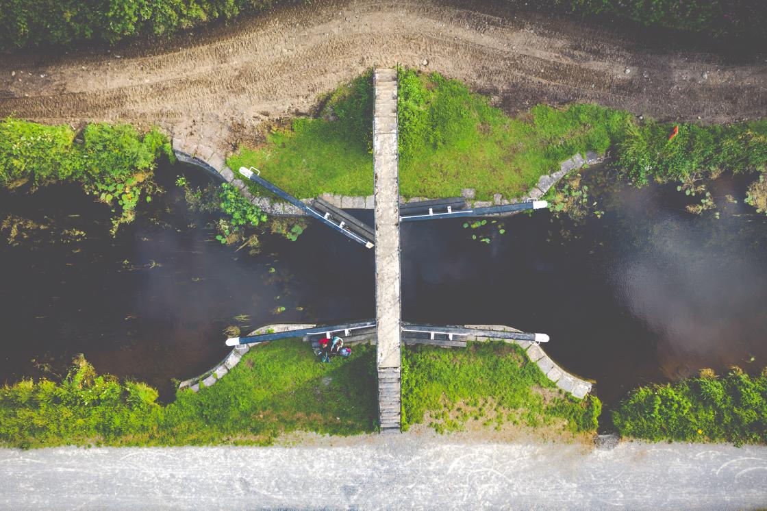
At Longwood Harbour, the Ribbontail Paddlers Club uses a restored lock keeper's cottage as its clubhouse. The club takes its name from the historic Ribbontail Footbridge, which was built to allow people attending Mass to cross the canal on their way to the church in Longwood.
Continue towards Hill of Down and you may even spot a barge making its way along the canal before the route continues towards Killucan.
A greenway with a fascinating history
The Royal Canal itself opened in 1817 and stretched from Dublin to the River Shannon. Its construction was an incredible feat of engineering, with the 146km manmade channel built long before the machinery and excavation equipment available today.
Horse-drawn fly-boats became an important form of transport, while barges carried goods along the canal. The arrival of the railways eventually changed how people and goods travelled, and the canal fell into disuse before closing in the 1960s.
Today, the revival of the Royal Canal has created an entirely different way to experience this historic waterway.
In Enfield, the canal's connection with the town is particularly strong. The Leisure Park beside the canal, located directly across from the railway station, makes an ideal starting point for exploring the Royal Canal Greenway.
The route between Enfield and Killucan is easy to negotiate on foot or by bike, with places to stop for refreshments along the way, including Furey's Bar in Moyvalley and Moran's Shop and Pub at Hill of Down.
Discover more around Enfield
The Royal Canal is only part of the story when visiting this part of the Boyne Valley. From Enfield, you are within easy reach of some of the region's best-known historic sites.
Visit Trim Castle, Ireland's largest Anglo-Norman castle, or explore the ancient landscape of the Hill of Tara, traditionally associated with the High Kings of Ireland.
You can also discover Tlachtga/Hill of Ward, associated with the origins of Halloween, visit the atmospheric ruins of Bective Abbey, or explore nearby Clonard and its monastic heritage.
The aqueduct where the Royal Canal crosses the River Boyne near Longwood Harbour is another reminder of the remarkable engineering behind the canal. It is worth stopping to appreciate the work involved in creating these waterways and the role they played in connecting communities across Ireland.
National Famine Way
The Royal Canal Greenway also forms part of the National Famine Way, an important heritage trail following the tragic journey of 1,490 Great Famine emigrants who travelled from Roscommon towards Dublin.
Monuments along the route at Hill of Down, Longwood and Enfield commemorate their journey and provide an opportunity to reflect on this important and difficult chapter in Irish history.
For more information and to help plan your journey, please click here to download the Royal Canal Greenway brochure.
Walking and cycling the Royal Canal Greenway
The Royal Canal Greenway is generally level and surfaced, with gradients kept to a minimum and plenty of places to stop and rest.
As the route is shared by walkers, runners and cyclists, it is important that everyone considers other users. Cyclists should travel at a safe speed, give way to walkers and use their bell when approaching.
Dogs should be kept on a short lead and owners should clean up after them. Appropriate clothing and footwear should also be worn depending on the weather and activity.
Although the greenway is largely off-road, there are locations where it crosses main roads. Always use designated crossing points where available and take particular care when crossing roads.
Find out more HERE!
One of the great things about exploring the Boyne Valley by greenway is that the journey itself becomes part of the experience.
Whether you are planning a leisurely afternoon by the canal, a family cycle or a weekend exploring the region's heritage, the greenways offer a chance to slow down, get outdoors and experience the Boyne Valley from a different perspective.
To keep up to date with news, events and special offers, sign up to our newsletter.